14.12.2020
An airborne BathyLiDAR survey is a cost-effective and efficient alternative for bathymetric mapping
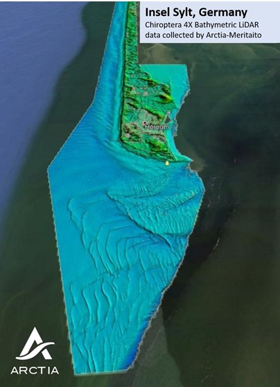
Arctia-Meritaito has once again successfully completed an airborne bathymetric LiDAR project. Our customers have been very satisfied with the performance of the state-of-the-art LiDAR sensor. The Leica Chiroptera 4X system is very efficient and a cost-effective solution for shallow water bathymetric mapping. Achieved point density is fulfilling general industry requirements, and water column penetration has proven to be in very high level. Topographic LiDAR data and aerial images are collected simultaneously, resulting in a seamless dataset from the ground to sea bottom.
Our latest project was delivered for the German state agency “Landesbetrieb für Küstenschutz”. The environmental conditions in the survey area were challenging, due to sandy seabed which was mixing with the water column. Despite the water turbidity, we collected an excellent dataset which is revealing the sand movements fantastically. The resulting deliverables exceeded customer expectations and were very useful for the intended purpose.
We are now looking forward to the next LiDAR project.
Please contact Patrik.Niskanen@arctia.fi, Tel. +358 40 848 5260, if you are interested to learn more about our efficient and cost-effective Bathymetric LiDAR services.